*The government signed an agreement to approve and promulgate the Master Plan for the Development and Management of the National Tourist Area of Vang Vieng District and Surrounding Areas for the years 2025 – 2035. The development of the Master Plan is a joint effort between the Ministry of Information, Culture and Tourism, the Ministry of Public Works and Transport, the Ministry of Natural Resources and Environment, in collaboration with the Vientiane Provincial Administration, Vang Vieng District Administration, Hansen Partnership, and Archineer.
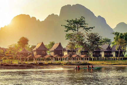
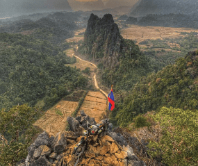
The purpose of the Master Plan is to serve as a reference for the government, business, and other stakeholders in developing the tourist destination in a way that does not affect the environment and ensures sustainability. This Master Plan covers a total area of 23,456 hectares, including Vang Vieng City and the surrounding landscape along the valley and the Nam Song River. Currently, the city centre and surrounding areas cover a total area of 6,553 hectares, covering 15 villages and the city centre area covers an area of approximately 185 hectares.

Source: Tourism Development DepartmentTourism Development Department
Laotian Language Text:
https://kpl.gov.la/detail.aspx?id=88985
ຮັບຮອງເອົາເມືອງວັງວຽງ ເປັນແຫລ່ງທ່ອງທ່ຽວລະດັບຊາດ
28/01/2025 11:39
*ລັດຖະບານ ເຊັນຂ້ໍຕົກລົງຮັບຮອງ ແລະ ປະກາດໃຊ້ແຜນແມ່ບົດພັດທະນາ ແລະ ຄຸ້ມຄອງເຂດການທ່ອງທ່ຽວລະດັບຊາດ ເມືອງວັງວຽງ ແລະ ບໍລິເວນອ້ອມຮອບ ສຳລັບປີ 2025 – 2035. ການສ້າງແຜນແມ່ບົດສະບັບດັ່ງກ່າວແມ່ນເປັນການປະສານສົມທົບກັນ ລະຫວ່າງ ກະຊວງຖະແຫລງຂ່າວ, ວັດທະນະທຳ ແລະ ທ່ອງທ່ຽວ, ກະຊວງໂຍທາທິການ ແລະ ຂົນສົ່ງ, ກະຊວງຊັບພະຍາກອນທຳມະຊາດ ແລະ ສິ່ງແວດລ້ອມສົມທົບກັບອົງການປົກຄອງແຂວງວຽງຈັນ, ອົງການປົກຄອງເມືອງວັງວຽງ, ບໍລິສັດ Hansen partnership ແລະ ບໍລິສັດ Archineer.
ຈຸດປະສົງຂອງການສ້າງແຜນ ແມ່ບົດແມ່ນເພື່ອເປັນບ່ອນອີງໃຫ້ແກ່ພາກລັດ, ພາກທຸລະກິດ ແລະ ພາກສ່ວນກ່ຽວຂ້ອງຕ່າງໆ ໃນການພັດທະນາເພື່ອບໍ່ໃຫ້ສົ່ງຜົນກະທົບຕໍ່ສະພາບແວດລ້ອມຂອງ ເມືອງທ່ອງທ່ຽວ ແລະ ຮັບປະກັນຄວາມຍືນຍົງ. ແຜນແມ່ບົດສະບັບນີ້, ໄດ້ກວມເອົາເນ້ືອທ່ີທັງໝົດ 23.456 ເຮັກຕາປະກອບດ້ວຍຕົວເມືອງວັງວຽງ ແລະ ພູມສັນຖານບໍລິເວນອ້ອມຮອບລຽບຕາມຮ່ອມພູ ແລະ ເຂດລ່ອງສາຍນ້ຳຊອງ. ໃນນ້ີ, ພ້ືນທ່ີຂອບເຂດໃຈກາງຕົວເມືອງ ແລະ ບໍລິເວນອ້ອມຮອບມີເນື້ອທີ່ທັງໝົດ 6.553 ເຮັກຕາ, ກວມເອົາ 15 ບ້ານ ແລະ ພື້ນທີ່ ໃຈກາງຕົວເມືອງ ກວມເອົາເນື້ອທີ່ປະມານ 185 ເຮັກຕາ.
ແຫລ່ງຂ່າວ:ແຫລ່ງຂ່າວ:
ກົມພັດທະນາການທ່ອງທ່ຽວກົມພັດທະນາການທ່ອງທ່ຽວ
